Want to know how often Google Earth updates? If yes, then you’re in right place. In this blog post, I’m going to answer all your queries related to Google Earth and how often Google Earth updates images and maps. Before proceeding further, I would like you to know about Google Earth first. So, let’s get started:
What is Google Earth?
Google Earth (formerly known as the Keyhole EarthViewer) is another splendid product from Google that is a three-dimensional planetary browser that shows a 3D image of Earth (well, except a few top-secret military bases) in satellite imagery and aerial photos. It also allows users to see all around the globe on their computer desktop or mobile screen.
Google Earth lets you explore the world with the tip of your fingers. It’s like having a virtual world tour of places you wish to visit. Whether you’re feeling nostalgic about seeing your hometown or want to explore where to travel next, Google Earth puts the whole world in your hands. You can spin the globe at your fingertips, zoom in and zoom out as you like.

The vision behind Google Earth is to act as a geographical browser that merges all the images received from satellites in composite form and binds them to form a 3D representation. Google Earth should not be confused with Google Maps, as these are two separate programs/services.
“You find your way through Google Maps, while Google Earth is about getting lost.”
– Gopal Shah, Product Manager at Google Earth
Get the new Google Earth now on the web in Chrome, on Google Play Store for Android as well as on App Store for iOS and other web browsers.
7 Different Versions of Google Earth
Google Earth has been released on macOS, Linux, iOS, and Android. Google Earth was released for Android on February 22, 2010, and on iOS on October 27, 2008. The mobile versions of Google Earth can make use of multi-touch interfaces to move on the globe, zoom or rotate the view, and allow to select the current location.
An automotive version of Google Earth was made available in the 2010 Audi A8. On February 27, 2020, Google opened up its web-based version of Earth to browsers like Mozilla Firefox, Microsoft Edge, and Opera.
Following is a list of 7 different versions of Google Earth:
- Google Earth Pro
- Google Earth Plus
- Google Earth Enterprise
- Google Earth Studio
- Google Earth 9
- Google Earth Plug-in
- Google Earth VR
Understanding Google Earth
Google Earth utilizes satellite-based photography from NASA and the U.S. Geological Survey’s (USGS) Landsat 8 satellites. These satellites deliver very detailed views covering almost the entire surface of the earth. Google accesses these images and uses a sophisticated algorithm to detect cloud cover and replace overcast areas with previous footage to get an uninterrupted view of the globe. All this information is put into a copy of the Google Earth Engine, which crunches all the data and creates the map.
The Landsat program is government-funded, but the data it gathers is available to the entire world. Scientists, researchers, environmental groups, and Google employees are just some people who access the information to learn more about the planet and how it changes over time.
According to Google, the data they collect from the Landsat program amounts to almost a petabyte or 700 trillion pixels. It would take almost a billion 1280×960 desktop monitors to display the entire map at once!
How Does Google Earth Collect Images and Pictures?
The images you see on Google Earth get collected over time from platforms and providers. You can see shots in 3D View, Aerial View, and Street View Photography. However, these pictures are not real-time, so it is impossible to see live images or changes via Google Earth.
Street View photography is what you might be familiar with from Google Maps. This is collected by cars mounted with cameras that literally drive around and capture the images.
Some images show a single acquisition data, while others show a range of dates taken over days or months. Assume, you can get more details about when an image got created on Google Earth, in that case, it is best to contact the original provider, as Google is unable to provide you with more information about the pictures it shows.
If you think that you can zoom in to your current location on Google Earth and see yourself standing on the street, then you might want to rethink. As we have already mentioned above, all the images shown on Google Earth are collected from different satellites.
Google Earth’s Incredible 3D Imagery, Explained
How Often Does Google Earth Update Photos, Maps, and Street View?
As per Google Earth’s official blog, Google Earth updates about once a month. However, this doesn’t mean that every picture or image on Google Earth is updated every month. In fact, the average map data on Google Earth is between one and three years old. Google Earth does update every month, but a small portion and it is impossible for an average person to detect those updates.
One to three years time range is intelligible given how many images and pictures are required to create Google Earth. There are so many satellites capturing images in space, among other places, that Google can use for this project.
Hence the updates of images, street views, and maps of Google Earth depend on the following three factors:
- Location and Area
- Time and Money
- Security
- Weather
1. Location and Area
A regular update of urban areas makes more sense than the rural areas. As, urban areas are more prone to changes, and that requires Google to cope with the changes. Along with its own satellite, Google also collects pictures from various third parties to speed up Google Earth update processes. Therefore, more updates on high-density areas speed up drastically.
2. Time and Money
Google does not own all the resources; it needs to buy a certain part of its pictures from other parties and this is where time and money come into the role. The third parties do not have time to transmit aerial photos from all over the world; neither do they have money to invest in that.
You might have witnessed that sometimes all you can see is a blurry image when you zoom in too much, and a few times you get to see the car parking of your site clearly. Those high-resolution images on Google Earth are constructed by aerial photography, which is not done by Google. Google buys such images from the third party that clicks these images. Hence making money and time a factor of Google Earth updates.
3. Security
There are numerous confidential locations, such as restricted military bases that are rarely updated due to national security reasons. Some of these areas have been blacked out forever. It is not only for government-led areas, but Google also stops updating areas where suspicions arise of using images for criminal activities.
4. Weather
There’s no point snapping images of a place that is constantly covered by clouds. There’d be nothing to see. As such, it can sometimes take time for Google to get clear shots that aren’t impeded by the weather.
An example of this is London. When Google wants to fly their aircraft to snap high-resolution photos, they have to wait a long time to capture photos when it isn’t raining or overcast.
What Does Google Earth Update?
Ah, there’s a rub. If you’re anxiously awaiting a Google Earth update on your hometown, don’t think it will appear in Google’s next changes or updates. Google does not update the entire map on Google Earth each go. Instead, it updates portions of the map.
A single Google Earth update might consist of a handful of states or cities. When Google releases an update, they also release a KLM file (mostly used for Keyhole Markup Language (Google Earth) files) that summarizes the updated regions in red, letting everyone know what got updated or changed and what’s still waiting for a refresher.
Why Doesn’t Google Earth Update Continuously?
As mentioned earlier, Google Earth combines satellite photos and aerial images. Both take time to obtain and implement, and aerial photos are relatively expensive. Google would have to constantly hire pilots traversing the globe to keep up with potential changes.
Instead, Google opts for a compromise. They strive to keep each area of the globe within three years. Although, they are likely to target high-density population areas more frequently. So if your town had an update last year, and you’re still waiting to see the new stadium built in the past six months, you might be waiting a while.
How To Request An Update To Google Earth Images

Wondering will Google Earth update imagery upon request? Yes! You can ask Google to update an image on Google Earth. Here’s how to request Google to update an image on Google Earth:
How To Ask Google To Update An Image on Google Earth
- Open Google Earth on your device.
- Navigate to the area that you would like to see updated.
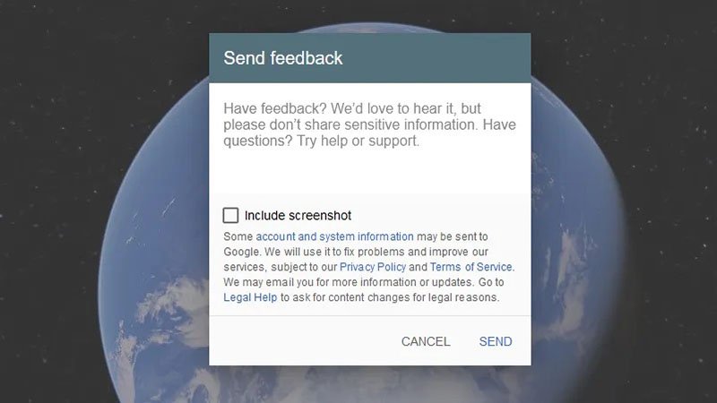
- You then need to use the feedback tool.
- On the browser version, click the three horizontal lines icon, then click Feedback. On the desktop, go to Help > Send Feedback.
- In the text field, input: I would like to recommend an imagery refresh.
Google compiles these requests to understand user interest. Sending a feedback request doesn’t assure that the image will be updated soon since it still depends on factors like image availability from third parties and weather conditions.
How To View Your House Using Google Earth
Google Earth is an extremely powerful tool. We’re lucky to be able to view some of the world’s wonders and hidden corners with just a single click. As Google Earth gets updated, it’ll continue to be an excellent historical record of how our Earth has changed or you can just go look at a satellite view of your house!
Conclusion
Given the extreme effort required to systematically catalog and piece together all the photos needed for Google Earth, it’s no surprise it takes years to update. While this situation is problematic, it is understandable. After all, the Earth is a prominent place.
Google Earth Frequently Asked Questions – (FAQs)
Are the images in Google Earth real-time?
No. The images in Google Earth aren’t real-time. Different satellites gather the images as they revolve around the earth over time, and it takes a specific cycle for each satellite to manage and update the images.
When was the last time Google Earth updated?
You can’t predict when a map or Google Earth will update, but you can get help from Google Earth to find out the date of its last update. With Google’s Follow Your World tool, you can also sign up for email notifications when specific location images change. If you go to the bottom of the satellite map, you see a date stamp marking the last update. This stamp is the easiest method of quickly determining the last update.
How often is Google Earth Street View updated?
In general, Google tries to take new Street View photos in major cities once every year. Less populated areas can probably expect new photos every three years or so — but don’t be surprised if it takes even longer.
Is there anything better than Google Earth?
Zoom Earth is, by far, the best alternative to Google Earth. It shows you satellite weather patterns right from the get-go, but you can also zoom in to see up-close images of streets and buildings.
How Often Does Google Earth Update?
According to Google Earth’s official blog, Google Earth updates about once a month. However, this doesn’t mean that every picture or image on Google Earth is updated every month.
via ©GadgetsBeat.


ليست هناك تعليقات:
إرسال تعليق